

GENERAL INFORMATION
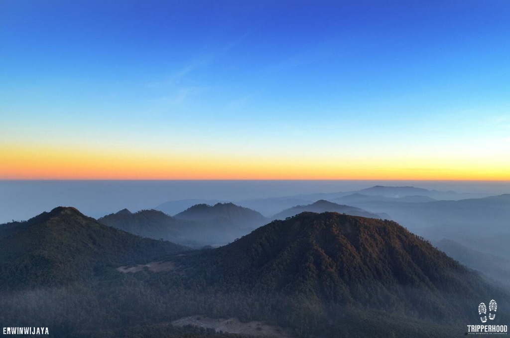
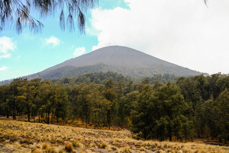
Semeru Mountain, lies at the southern end of a volcanic massif extending north to the Tengger caldera. Semeru has become the most favourite mountain trekking destination by now. It is the highest volcano in Java with 3.676 meters above sea level high, makes it one of Indonesia’s seven summit and one of the most active. Mount Semeru is a part of Bromo-Tengger-Semeru National Park (TNBTR). With the nearest cities are Malang and Lumajang.
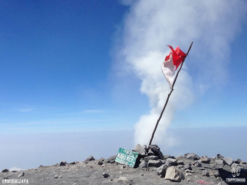
The peak of Semeru, called Mahameru, means ‘The Great Mountain’. The name derived from the Hindu-Buddhist mythical mountain of Meru or Sumeru, the abode of gods. Legend said that Semeru mountain was sent from India on 15th century BC. And the real peak was fallen off on its journey and become a small mountain named Penanggungan mountain.
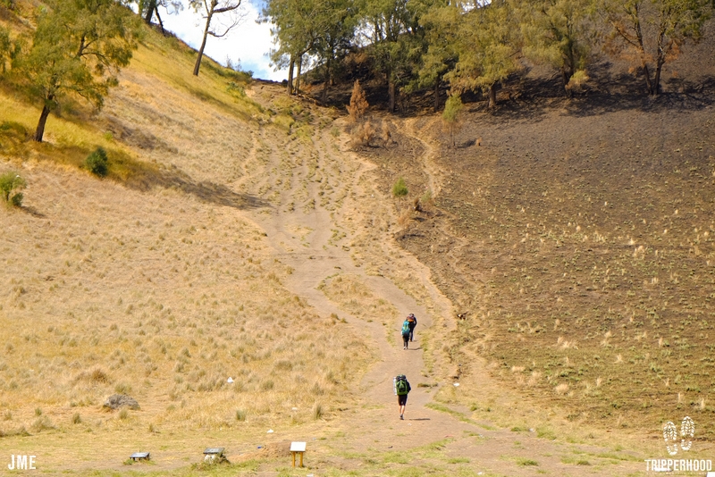
Semeru mountain tracking is considered quite easy compared to another mountains in Java, because of the flat-though long-track. But the summit requires hardwork and bravery. Only 1 route opens for travelers, others are limited to locals only. The beauty of this mountain has attract hikers from all Indonesia and abroad to witness themselves.
BEST TIME TO VISIT
Best time to hike Semeru is between May until September, because on December until March is rainy season in Indonesia with the frequent storms and landslides. National park are also closed during some of these times for natural rehabilitation.
TRACK AND DESTINATIONS
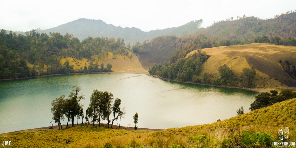
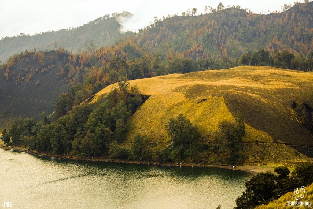
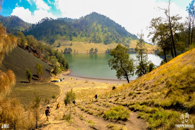
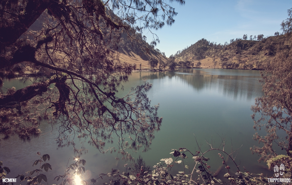
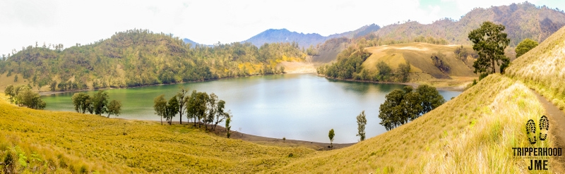
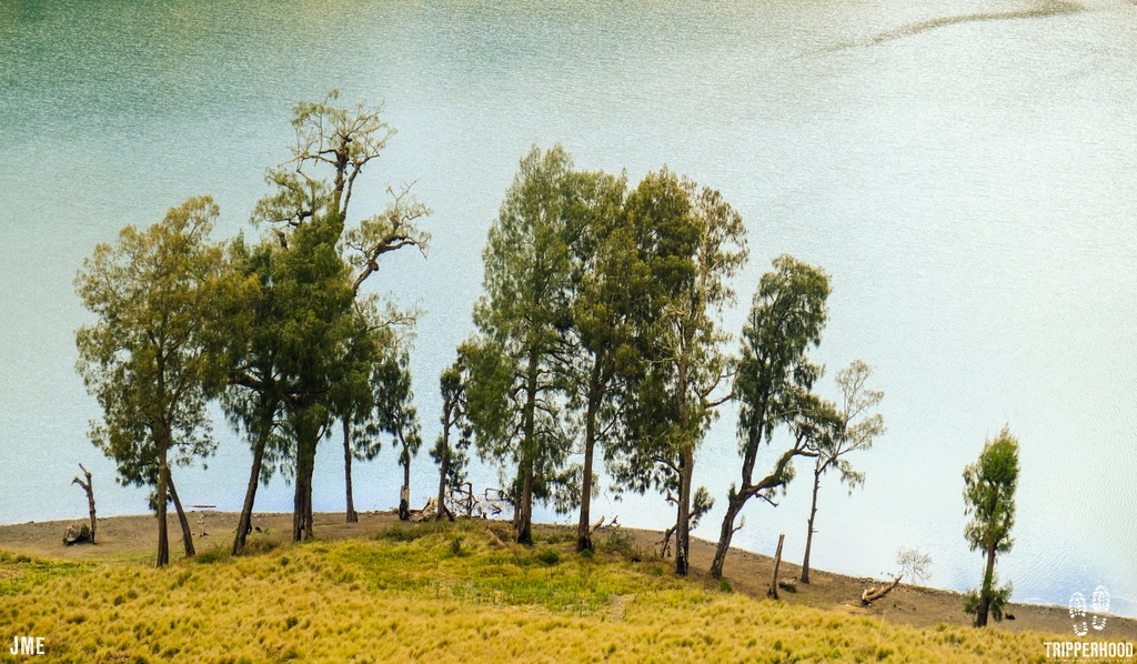
From Ranu Pane to Mahameru’s Peak, you will pass 4 checkpoints and 2 shelters. The first shelter is Ranu Kumbolo. Ranu Kumbolo is a big lake located about 2.400 meters above sea level. A lake with fresh water where you can see sun rises in the morning between two hills in the east. Ranu Kumbolo is considered the most beautiful part of Semeru mountain. To reach this shelter, we need 5 hours trekking through 9.5 km tracks. In your first 5 km to the shelter you will find edelweiss on the slope of the hill, stepping another km ahead you will see a beautiful valleys and hills with fir and pine trees around.
To reach the next shelter you will hike a famous steep hill called Tanjakan Cinta and behind that you will see very beautiful grassland called Oro – Oro Ombo. After passing this grassland you will hike to the pine forest called Cemoro Kandang where climbers sometimes find deer and birds.
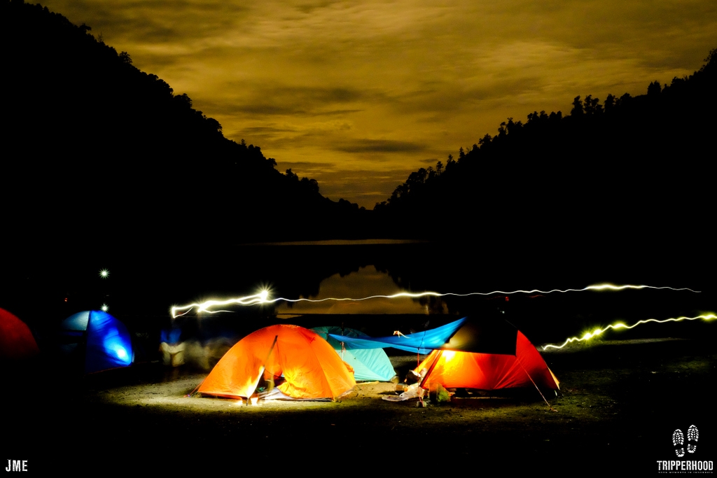
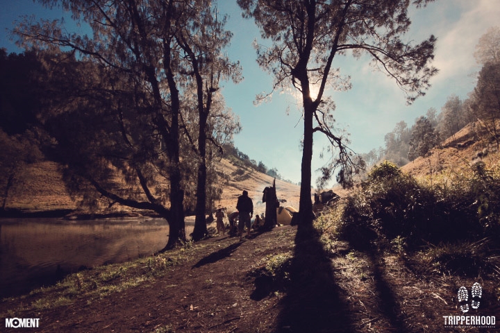
You almost there, in the end of the pine forest you will reach Jambangan, a place with flat land, grass, edelweiss, and a direct view to Mahameru’s peak, which means you’re getting closer. You can take a rest here and take some photographs. From there, you only need 30 minutes walking through the forest to reach Kalimati. Kalimati is a shelter with large grassland in the edge of the pine forest 2.700 meters above sea level. Here, climbers can build a tent before summit attack after midnight at 12.00 am. Total from Ranu Kumbolo is two km trekking with range of time 3 up to 4 hours to reach this Kalimati
Arcopodo is a place 200 meters higher from Kalimati. To reach this place, climbers need 1 to 2 hours climbing through steep pine forest. Another 30 minutes climbing, we will find Kelik, the last vegetation area before the dunes. From there, use your mask and goggle.
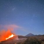
Start your summit attact at 12.00 am. It needs 4 – 5 hours climbing through steep dunes and easily degenerates. It was painstaking as a 60-degree climb on sandy terrain offers unstable footing, which is energy-sapping, as well as the constant fear of falling rocks from above. Follow the existing tracks and be very careful. Use your headlamp and watch your step while climbing the dunes. Happy Climbing!
TEMPERATURE
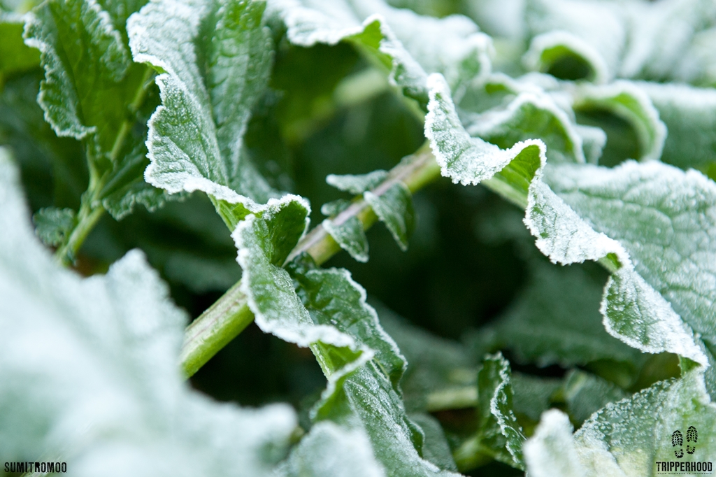
Hikers performing the so-called “summit attack” must start ascending at midnight, in the face of strong winds with temperature about 4-10°C and minus-zero temperatures in the dry season. The wind blows hard and sometimes stormy between December to January. It’s also freezing in Ranu Kumbolo and Kalimati, the shelter camp. So grab your jackets closely.
CONDITION
There’s few or none toilet and food stalls in Semeru. We make our own food with camping gears and have dinner under 500 billions stars. It will be very romantic!
ATTENTION REQUIRED
Positive attitude for sure
Health certificate from doctor, mentioning you’re fit enough to hike, is required
Mountain gears (carrier, trekking shoes, raincoat, warm cloths, sleeping bag, mattress, headlamp, etc)
Camera and all of the gears (you’ll be amaze with the landscape, both with the light or darkness)
Snack (chocolate, energy bar), mineral water, personal medicine, etc
Wet and dry tissues.
Start climb around 12.00 am to reach summit before sunrise
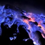
Down from summit before 10.00 am to avoid poisonous gas on your direction
Don’t get too close to the crater Jonggring Saloko
Avoid climbing from south side because of the poisonous gas and lava flows
Have your complete gear to avoid Hypothermia and Hypoxia
Have plactic cover for your stuff when the rain comes
Use daypack (small bag ±30 liter) to carry your snack, water and camera for summit
Water supplies are from Ranu Kumbolo Lake and Kalimati
There are many cases where electronic goods such as cameras were damaged due to dust entering, consider using extra protection.
Take nothing but pictures, leave nothing but memories. Preserved our nature!
To watch sunrise on the summit of Semeru Mountain is definitely worthwhile, with Java’s coastline, nearby mountains and cities creating a picture-perfect horizon above the clouds. Or laying back by the Ranu Kumbolo lake, away from civilization. Semeru is a heaven on earth!
Join one of our packages in Semeru Mountain
or create your own dream package!